| State Route 16 | ||||
|---|---|---|---|---|
| Route information | ||||
| Defined by S&HC § 316 | ||||
| Maintained by Caltrans | ||||
| Length: | 111.17 mi[2] (178.91 km) (includes 28.82 mi (46.38 km) on I-5 and US 50) |
|||
| Existed: | 1934[1] – present | |||
| Section 1 | ||||
| West end: | SR 20 near Rumsey | |||
| East end: | I-5 in Woodland | |||
| Section 2 | ||||
| West end: | US 50 near Sacramento | |||
| East end: | SR 49 near Drytown | |||
| Highway system | ||||
|
State highways in California(list • pre-1964)
|
||||
State Route 16 (SR 16) is a state highway in the northern region of the U.S. state of California that runs from Route 20 in Colusa County to Route 49 just outside Plymouth in Amador County. It is discontinuous near Sacramento, being an unsigned route that runs concurrently with both Interstate 5 and U.S. Route 50.[3]
Contents |
SR 16 is part of the California Freeway and Expressway System[4] and is eligible for the State Scenic Highway System.[5] However, it is not designated as a scenic highway by Caltrans.[6] It is known as the Stanley L. Van Vleck Memorial Highway from Dillard Road in Sacramento County to the Amador County line.[7]
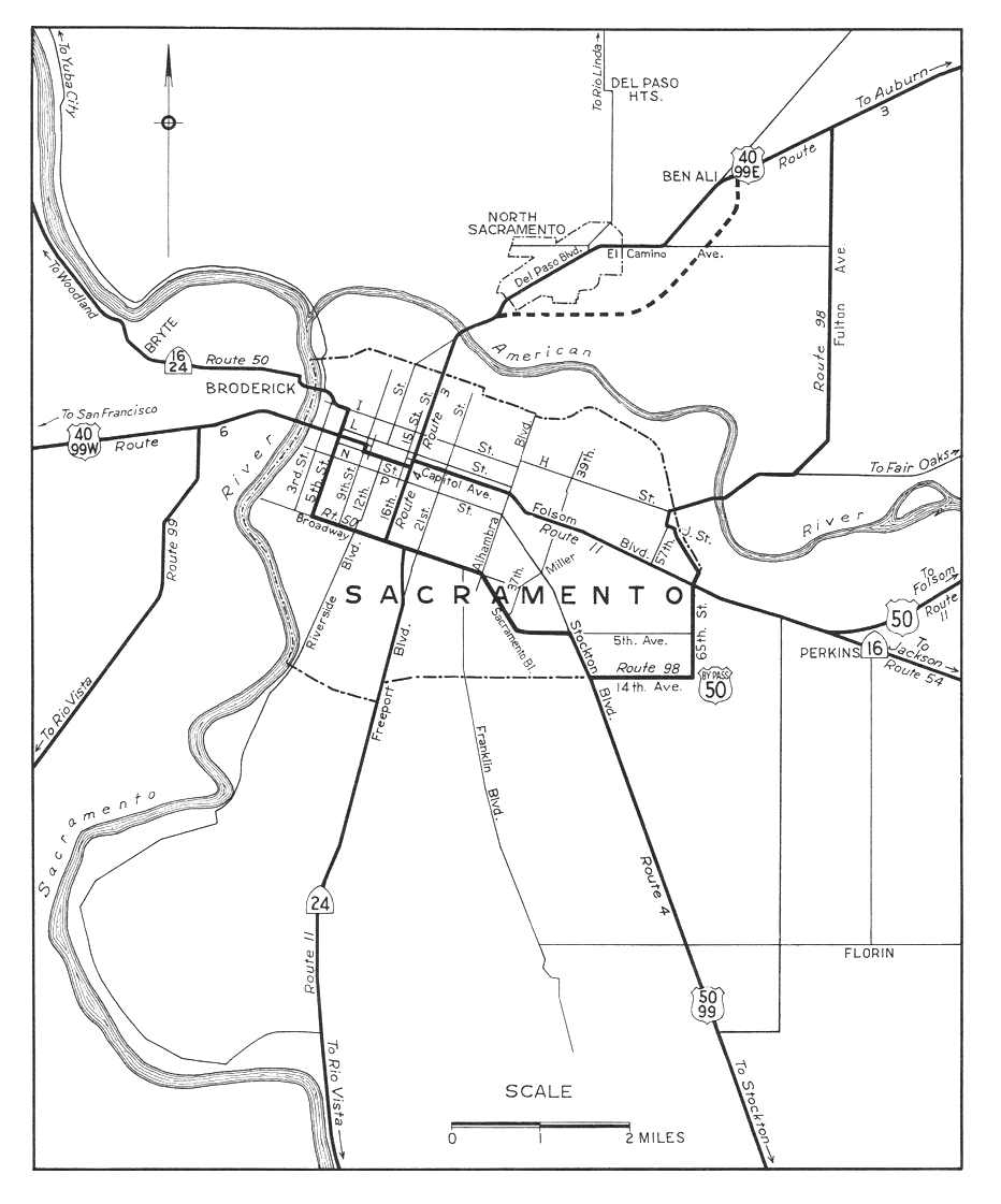
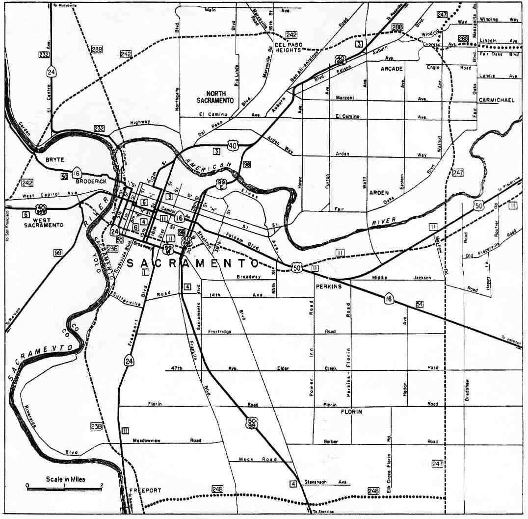
State Route 16 begins in Colusa County near Wilbur Springs at the junction with State Route 20. A few miles south of this terminus, SR 16 enters Yolo County and passes Cache Creek Canyon Regional Park. SR 16 parallels Cache Creek on its routing from the county line to the end of the western segment. SR 16 then goes through Rumsey, Guinda, Brooks, Capay, Esparto, and Madison, intersecting with County Route E4 and passing by the Blue Cliffs and Bald Mountain in the process. East of Madison, SR 16 interchanges with Interstate 505 before heading east toward Woodland. In Woodland, at the junction with County Route E7 southbound, SR 16 turns north and merges with Interstate 5 southbound. Although SR 16 continues on Interstate 5 south to U.S. Route 50, this concurrency is not signed or designated on most maps.[3][8]
The eastern segment of SR 16 begins at U.S. Route 50 east of Sacramento. SR 16 heads east through Perkins as Jackson Road. After it passes near Bridge House and Rancho Murieta, where it crosses the Cosumnes River, SR 16 enters Amador County. SR 16 then ascends into the Sierra Nevada foothills, leaving the Central Valley. In Amador County, SR 16 passes near Forest Home before intersecting with State Route 124 and terminating at State Route 49.[3][8]
The two ends of SR 16 were added to the state highway system by the third bond issue, passed by the state's voters in 1919: Route 50 from Lower Lake east to Rumsey and Route 54 from the Sacramento-Amador County line east to Drytown.[9] Each was connected to Sacramento by existing or planned paved county highways.[10] Although the exact alignment of Route 50 was not specified, the state Department of Engineering had already surveyed a 35-mile (56 km) route through Cache Creek Canyon pursuant to a 1915 law, which defined the Yolo and Lake Highway "following generally, the meanderings of Cache creek" but did not make it a state highway.[11][12] By 1924, the California Highway Commission's engineers had realized that building Route 50 through the canyon was impractical, and adopted a substitute plan for two highways connecting Lower Lake and Rumsey with the planned Route 15 (Tahoe-Ukiah Highway, now State Route 20) to the north[13] in September 1925.[14][15] The western connection, to Lower Lake, became part of Route 49 (now State Route 53 there), which continued south from Lower Lake to Calistoga.
Each route was extended to Sacramento in 1933 over the aforementioned county highways, taking Route 50 southeast from Rumsey to Woodland near Cache Creek and then alongside the Sacramento River to the I Street Bridge, and Route 54 west from the county line to Route 11 just outside Sacramento.[16][17] The entirety of both routes, from SR 20 near Wilbur Springs through Sacramento to State Route 49 just north of Drytown (and initially overlapping SR 49 to Jackson), was included in the initial state sign route system in 1934 as Sign Route 16.[18] Through downtown Sacramento, SR 16 followed U.S. 40 (Legislative Route 6) and U.S. 50 (Legislative Route 11), mostly on Capitol Avenue, while Legislative Route 50 continued south on 5th Street (later a one-way pair of 3rd and 5th Streets) and turned east on Broadway, carrying Sign Route 24 most of the way to Freeport Boulevard.[19][20] In the 1964 renumbering, Route 16 became the new legislative designation,[21] and Sign Route 24 through Sacramento was replaced with State Route 99 and State Route 160. As neither of these used what had been Sign Route 24 along 3rd and 5th Streets and Broadway, part of Route 16's new definition ("Route 5 near Woodland to Sacramento") was used for several years on this alignment until it became part of State Route 99 later that decade. This left the western segment of SR 16 ending at Interstate 5 near the east end of the I Street Bridge[22] until 1984, when the Woodland-Sacramento portion, which had become redundant with the parallel Interstate 5 complete, was deleted from the legislative definition.[23] It was at about this time that SR 16 was rerouted from the intersection with County Route E7 to continue north on a bypass of Woodland instead of east to Interstate 5.[1]
| County | Location | Postmile [24][25][26] |
Destinations | Notes |
|---|---|---|---|---|
| Colusa COL 0.00-7.26 |
Wilbur Springs | 0.00 | SR 20 – Williams, Clearlake, Ukiah | |
| Yolo YOL 0.00-R43.42 |
Capay | CR E4 (Road 85) – Dunnigan | ||
| 32.23 | I-505 – Redding, Vacaville | Interchange | ||
| Woodland | R40.57 | I-5 Bus. south (Main Street) / CR E7 (Road 98) | West end of I-5 Bus. overlap; Main Street was former SR 16 east | |
| R43.42 | I-5 / Road 18 – Redding, Sacramento | Interchange; east end of I-5 Bus. overlap | ||
| Gap in SR 16 | ||||
| Sacramento SAC T1.66-R23.96 |
Sacramento | T1.66 | US 50 (El Dorado Freeway) / Howe Avenue – South Lake Tahoe, Sacramento | Interchange |
| T1.95 | Folsom Boulevard west, Power Inn Road | Former SR 16 west / US 50 west | ||
| T2.53 | Folsom Boulevard east, Notre Dame Drive | Former US 50 east | ||
| 3.02 | Florin Perkins Road | |||
| 4.17 | South Watt Avenue | |||
| 6.22 | Bradshaw Road – Elk Grove | |||
| Rancho Cordova | R11.47 | CR E2 (Sunrise Boulevard) | ||
| 12.54 | Grant Line Road – Folsom, Sheldon, Elk Grove | |||
| Amador AMA R0.00-9.37 |
9.09 | SR 124 – Ione | ||
| Central House | 9.37 | SR 49 – Placerville, Jackson | ||
| 1.000 mi = 1.609 km; 1.000 km = 0.621 mi Concurrency terminus • Closed/Former • Incomplete access • Unopened |
||||